 |
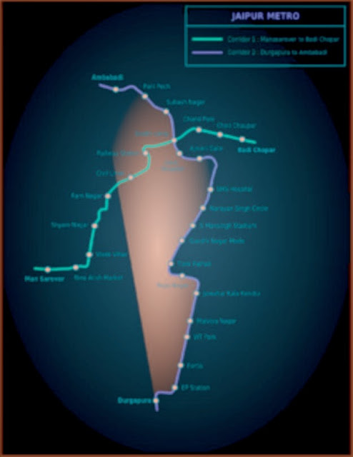
| Jaipur metro Map |
Jaipur Metro Route
Jaipur, the ‘symphony in pink’, is the land of superlatives, where breathtaking beauty and rich art & culture blend superbly. It nestles amidst the Aravali ranges and is surrounded by rugged hills on three sides, each crowned by a formidable fort, while the city is studded with grand palaces, majestic mansions and gracefully landscaped gardens and parks. It is perhaps the first planned city of India, and was laid with great precision on the basis of principles of 'Shilp Shastra', the ancient Hindu treatise on architecture. The city was built in the form of a rectangle divided into blocks (Chowkries), with roads and avenues running parallel to the sides. In 1863 city of Jaipur was dressed in Pink to welcome Prince Albert, consort of Queen Victoria. The colour became an integral part of the city and it came to be known as ‘The Pink City’.
Though the city has grown into a modern metropolis and a throbbing commercial center, the city is a visitor’s delight and caters to the needs of each form of tourism, ranging from historical, culture, adventure, sports, entertainment, shopping, business, conventions and conferences. Jaipur is also a renowned handicraft center and is also known for producing exquisite gold jewellery enamelled or inlaid with precious or semi-precious stones, blue pottery, carvings on wood, stone and ivory, block print and tie & dye textiles, leather articles, handmade paper, miniature painting etc.
Jaipur Metro Route Alignment
East – West Corridor: Mansarovar to Badi ChauparFrom dead end (Ch.-1218.93m) of Mansarovar station to dead end of Badi Chaupar station (Ch. 10848.496m), the length of the corridor 2 is 12.067 km, out of which 2.789 km is under ground and remaining 9.278 km is elevated, including Switch Over Ramp.Total 11 number of stations have been planned along this corridor out of which 8 are elevated and 3 are underground stations.
Corridor-1(North-South): Sitapura Industrial Area to Amba BariFrom dead end (Ch. - 450 m) of Sitapura Industrial Area station to dead end of AmbaBari station (Ch.22648.943 m), the length of the corridor is 23.099 km, out of which 5.095 km is under ground and remaining 18.004 km is elevated, including Switch Over Ramp. Total 20 number stations have been planned along this corridor out of which 15 are elevated and 5 are under ground stations
Type in Text here and Click on Source button
| Station No | Station Name | Distance(km) |
| 1 | Mansarovar | 0 |
| 2 | New aatish Market | 1.454 |
| 3 | Vivek Vihar |
1.105
|
| 4 | Shayam Nagar | 0.881 |
| 5 | Ram Nagar |
0.747
|
| 6 | Civil Lines | 1.086 |
| 7 | Railway Station | 1.583 |
| 8 | Sindhi Camp |
1.338
|
| 9 | Chand Pole | 0.786 |
| 10 | Choti Chopar | 1.221 |
| 11 | Badi Chopar | 0.853 |


.jpg)


0 comments:
Post a Comment